December 8th, 2018
Golden Ears Park is one of those parks that you can enjoy no matter what the weather is like, especially if you decide to do the Golden Ears Canyon Loop. Just make sure you dress accordingly of course!
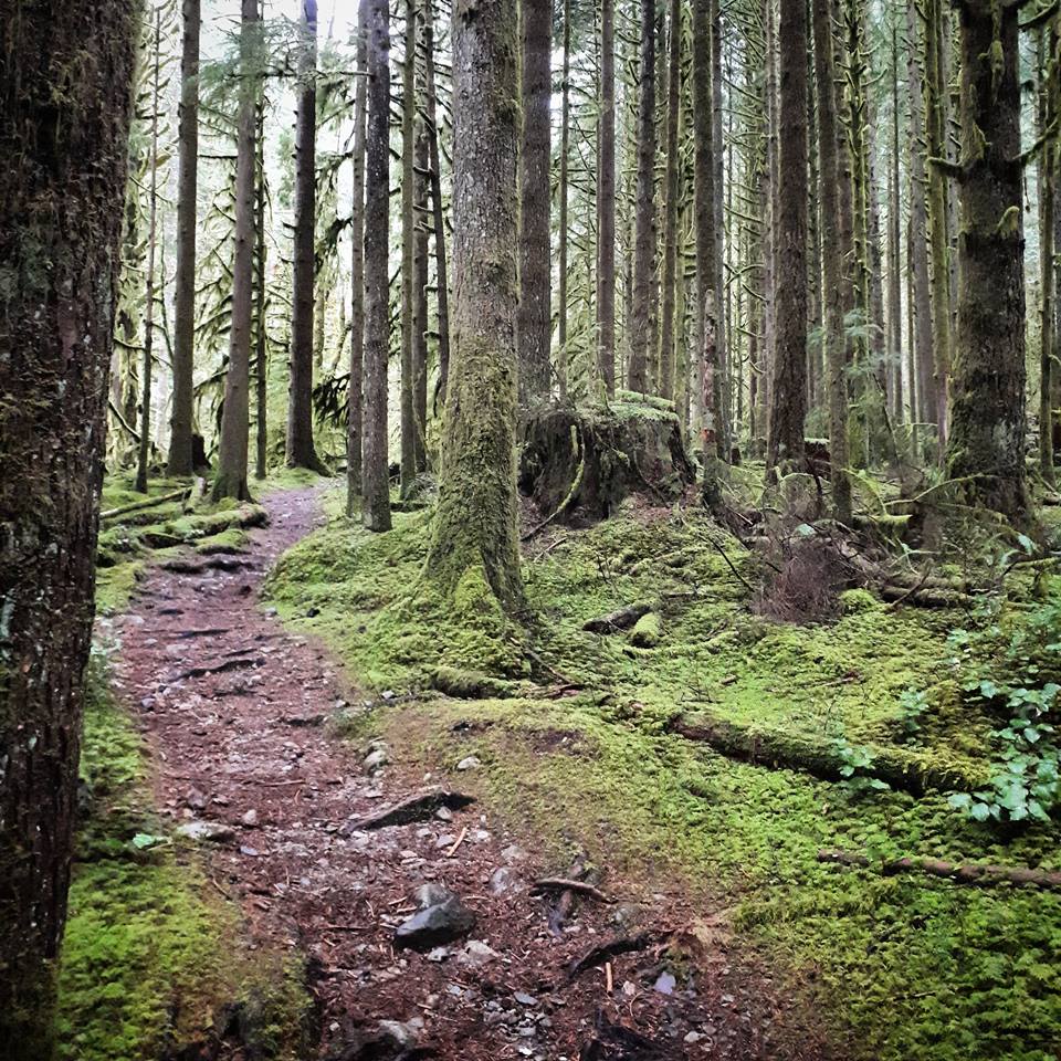
A few of us did the Golden Ears Canyon Loop and Upper Falls trail on this wet and soggy day. Even on a moody day the views were spectacular. Fog was seeping through the green mossy trees which made the trail look quite mystical. The Golden Ears Canyon loop mainly connects the East Canyon trail and West Canyon trail with the East/West Canyon Connector Bridge. You also need to take a small part of the Menzies trail to finish the loop.

I followed the map provided by All Trails as it included the details for detouring to Upper Falls. I was also able to download the offline map (as I am a pro member) which was very useful because there is no cell service at Golden Ears Park and we did get confused near the end of our loop. I will provide some details later in this post about this but I would recommend you download the same map as a backup.
East Canyon Trail
We started the Golden Ears Canyon Loop at the Gold Creek Day use parking lot and headed to the East Canyon Trail. As you start the trail keep right at the beginning of the trail and continue on this trail.
The trail is pretty easy but I recommend you wear waterproof boots. There are some small creeks to jump over and if it is raining out or has been rainy then the trail can be a bit muddy. Good tread on your boots is also necessary this time of year as there were many icy patches later on in the trek.

Upper Falls Trail
After about 45 minutes of hiking the East Canyon trail we took the detour to Upper Falls. There is no clear signage to Upper Falls so it is not as popular as the Lower Falls but it is actually, in my opinion, much nicer. One of the hikers today (Charly) had already been to Upper Falls so she was able to direct us which was nice!
The trail starts shortly after the Lower Falls trail detour. Go past the Lower Falls detour sign and take the next small trail detour on the left of a big flat rock. You will begin to see orange/pink marking tape on the trees. This is a short trail down (maybe 1 km off of the East Canyon Trail), a bit steep and a little tricky with the footing so be careful. It was hard to get any photos of the trail as it was pouring rain and I wanted to save the photos for the falls.

Usually you can get a bit closer to the falls but it was super icy on the rocks. The falls looked pretty cool with the icicles forming around it. This was as far as we could go today (pictured below) before it got too icy.

West Canyon Trail
We started as a group of 4 but then only 2 of us carried on to finish the loop. To get to the West Canyon trail you need to take the East/West Canyon connector bridge. It is clearly marked and only about 15 minutes past the Upper falls turn off on your left. It is a very beautiful bridge that crosses Gold Creek.


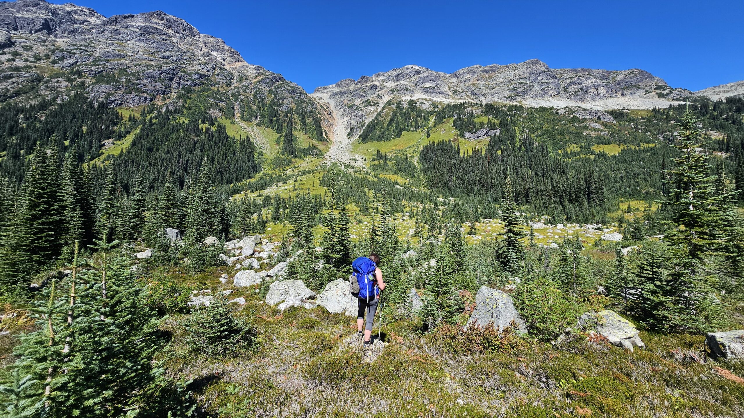
The West Canyon trail is definitely a lot more scenic than the East Canyon trail. It is also the longer portion of the loop. I would say the West Canyon trail is about 2/3rd’s of the loop. The variety of terrain, bridges to cross, plus the higher elevated views of Gold creek is what makes the West Canyon trail more scenic.

Menzies Trail to Gold Creek Bridge
As we were nearing the end of the loop, we did not realize we needed to switch to the Menzies trail to get back to the Gold Creek day use parking lot. So we came out at the parking lot by the Golden Ears Group Campground. There is a map near the junction of trails but we found it easier to follow the map by All Trails to make it back to the right parking lot. Take the Menzies trail towards Gold Creek Bridge (turn left from the West Canyon trail). It is a small trail by a green water treatment tank.
This part of the trail was filled with Golden Ears Park’s classic mossy trees!
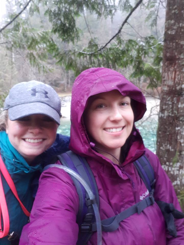
When you come out of this portion of the trail, you will be back on the gravel road you drove in on and you will have to walk across the bridge back to the parking lot. We took a nice little pit stop down by the river to check out Gold Creek. The river is a vibrant turquoise colour that stood out from the moody weather.

Definitely check out this trail!
The Golden Ears Canyon Loop is 12km with an elevation gain of 185m. It took us about 4 hours to complete with our detour to Upper Falls and a short lunch break.
I can’t wait to go back on a nicer day and spend some more time at Upper Falls. This is one of my favourite trails at Golden Ears Park now but I have many more on my list to accomplish there!
If you are heading to Golden Ears Provincial Park in the winter time, keep in mind that the gate is only open from 8am-5:30pm and often closes in the winter time due to snowfall.
What is your favourite trail at Golden Ears Provincial Park? Let us know in the comments section below!
For a list of Maple Ridge hikes including hikes in Golden Ears Park check out: Maple Ridge Hikes.
Thanks for sharing your experience. 😊
You’re welcome! Thanks for checking it out! 🙂